Cumberland State Forest
Appearance
| Cumberland State Forest | |
|---|---|
IUCN category VI (protected area with sustainable use of natural resources) | |
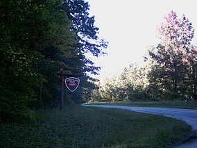
 Entrance of Cumberland State Forest | |
 | |
| Location | Cumberland County and Buckingham County, VA USA |
| Nearest city | Cumberland, VA |
| Coordinates | 37°0′0″N 78°0′0″W / 37.00000°N 78.00000°W |
| Area | 16,169 acres (65.43 km2) |
| Established | 1939 |
| Governing body | Virginia Department of Forestry |
Cumberland State Forest is a Virginia state forest located in the piedmont of the state, in Cumberland and Buckingham counties. The 16,169-acre (65.43 km2) forest borders the Willis River. Within its confines may be found Bear Creek Lake State Park and a small family cemetery containing the grave of Charles Irving Thornton; the grave marker, with its inscription by Charles Dickens, is on the National Register of Historic Places.
References
[edit]
